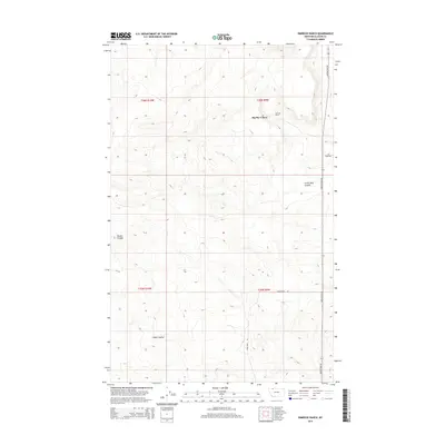
2014 Map of Rimrock Ranch
USGS Topo · Published 2014About this map
Big Sky Colony stands as a focal point in this portion of Glacier County, situated in a high-plains landscape defined by the drainage patterns of the northern Missouri River watershed. The terrain is marked by significant topographical depressions, including Little Rock Coulee and Powell Coulee, which serve as natural landmarks for the surrounding rangeland. The map detail reflects a sparsely populated area where the economy and social structure revolve around large agricultural holdings and communal living, exemplified by Rimrock Ranch. Local travel is facilitated by a grid of named routes like Meriwether Rd and Horsethief Rd, which trace the section lines of the Public Land Survey System. These roads provide the primary links between the isolated ranching complexes and the wider region, while Cobell Coulee carves through the southern sections of the survey area.
Find a feature on this map
12 named features on this map. Tap any name to fly to it.
Don’t see what you’re looking for? This feature index may not catch every label — zoom into the map to look around manually.
Map Details
Editions of this 2014 Rimrock Ranch Map
This is the sole edition of this map. No revisions or reprints were ever made.
Other maps of this area

1911 · Blackfoot
USGS Topo · 1:125,000

1960 · Cut Bank
USGS Topo · 1:250,000

1963 · Cut Bank
USGS Topo · 1:250,000

1964 · Cut Bank
USGS Topo · 1:250,000

1968 · Buffalo Lake
USGS Topo · 1:24,000

1968 · Rimrock Butte
USGS Topo · 1:24,000
1968 · Fort Piegan
USGS Topo · 1:24,000
1968 · Del Bonita
USGS Topo · 1:24,000
1968 · Sharp Lake
USGS Topo · 1:24,000

1968 · Landslide Butte
USGS Topo · 1:24,000