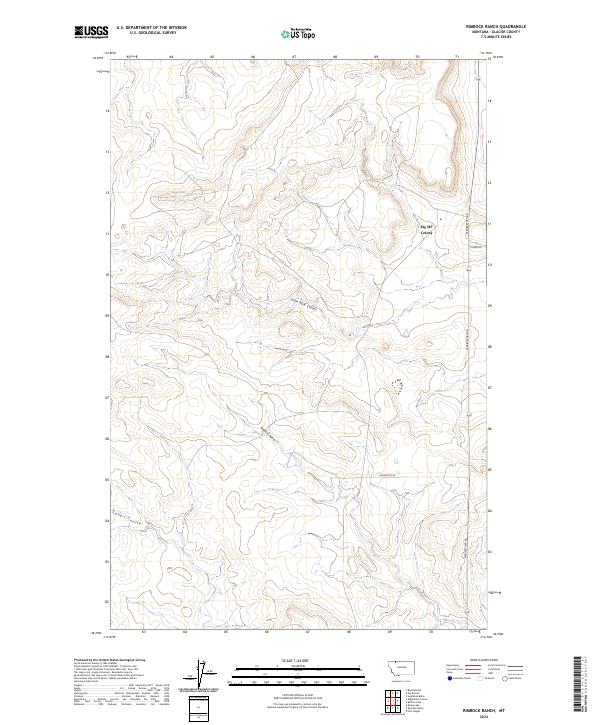
2024 Map of Rimrock Ranch
USGS Topo · Published 2024About this map
Big Sky Colony stands as a focal point of settlement in this northern Montana landscape, located along the eastern edge of the quadrangle. The terrain is defined by a series of deep drainages including Little Rock Coulee and Powell Coulee, which carve through the high plains. Further southwest, the Cobell Coulee continues this pattern of natural erosion, illustrating the water-sculpted character of the Glacier County geography.
Find a feature on this map
11 named features on this map. Tap any name to fly to it.
Don’t see what you’re looking for? This feature index may not catch every label — zoom into the map to look around manually.
Map Details
Editions of this 2024 Rimrock Ranch Map
This is the sole edition of this map. No revisions or reprints were ever made.
Other maps of this area

1911 · Blackfoot
USGS Topo · 1:125,000

1960 · Cut Bank
USGS Topo · 1:250,000

1963 · Cut Bank
USGS Topo · 1:250,000

1964 · Cut Bank
USGS Topo · 1:250,000

1968 · Buffalo Lake
USGS Topo · 1:24,000

1968 · Rimrock Butte
USGS Topo · 1:24,000
1968 · Fort Piegan
USGS Topo · 1:24,000
1968 · Del Bonita
USGS Topo · 1:24,000
1968 · Sharp Lake
USGS Topo · 1:24,000

1968 · Landslide Butte
USGS Topo · 1:24,000