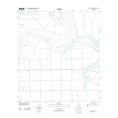
2013 Map of Rincon Bend
USGS Topo · Published 2013About this map
The Aransas River winds through the coastal plains of San Patricio County, carving the distinct fluvial features of Rincon Bend and Tule Bend. This landscape is defined by its industrial and agricultural utility, where a network of county roads organizes the flat terrain into large blocks. The energy sector is prominently represented by the Plymouth Gas and Oil Field and the Taft Oil and Gas Field, indicating the area's role in Texas's petroleum economy.
Find a feature on this map
34 named features on this map. Tap any name to fly to it.
Don’t see what you’re looking for? This feature index may not catch every label — zoom into the map to look around manually.
Map Details
Editions of this 2013 Rincon Bend Map
This is the sole edition of this map. No revisions or reprints were ever made.
Other maps of this area

1925 · Aransas Pass
USGS Topo · 1:62,500

1925 · Corpus Christi
USGS Topo · 1:62,500

1950 · Corpus Christi
USGS Topo · 1:250,000

1951 · Corpus Christi
USGS Topo · 1:62,500

1953 · Beeville
USGS Topo · 1:250,000

1954 · Rockport
USGS Topo · 1:62,500

1954 · Aransas Pass
USGS Topo · 1:24,000

1954 · Woodsboro
USGS Topo · 1:62,500

1954 · Aransas Pass
USGS Topo · 1:62,500

1956 · Corpus Christi
USGS Topo · 1:250,000