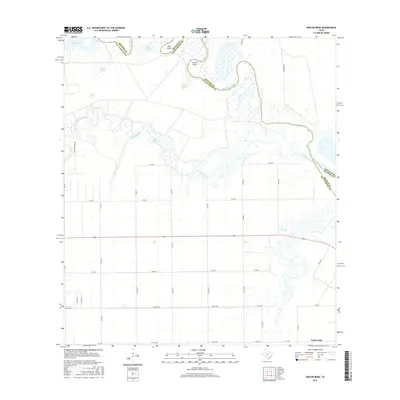
2016 Map of Rincon Bend
USGS Topo · Published 2016About this map
The Aransas River defines the meandering northern border of this South Texas landscape, creating dramatic oxbows and landforms like Rincon Bend and Tule Bend. This coastal plain environment is marked by a complex network of wetlands and seasonal water bodies, including Big Lake, Tule Lake, and the winding course of Chiltipin Creek. While much of the area is divided into large agricultural tracts accessed by a rigid grid of county roads, the southeastern corner reveals the residential pocket of Tradewinds. Ranching and irrigation history is evident in the presence of specialized water features such as Palomo Tank and Chico Tank, which supported livestock in this seasonally dry region. The map captures the interface between the San Patricio, Refugio, and Aransas county lines as they follow the natural, shifting path of the river.
Find a feature on this map
41 named features on this map. Tap any name to fly to it.
Don’t see what you’re looking for? This feature index may not catch every label — zoom into the map to look around manually.
Map Details
Editions of this 2016 Rincon Bend Map
This is the sole edition of this map. No revisions or reprints were ever made.
Other maps of this area

1925 · Aransas Pass
USGS Topo · 1:62,500

1925 · Corpus Christi
USGS Topo · 1:62,500

1950 · Corpus Christi
USGS Topo · 1:250,000

1951 · Corpus Christi
USGS Topo · 1:62,500

1953 · Beeville
USGS Topo · 1:250,000

1954 · Rockport
USGS Topo · 1:62,500

1954 · Aransas Pass
USGS Topo · 1:24,000

1954 · Woodsboro
USGS Topo · 1:62,500

1954 · Aransas Pass
USGS Topo · 1:62,500

1956 · Corpus Christi
USGS Topo · 1:250,000