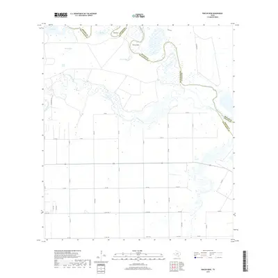
2019 Map of Rincon Bend
USGS Topo · Published 2019About this map
The Aransas River defines the northern boundary of this coastal prairie landscape, winding through a complex of wetlands and sharp oxbows like Rincon Bend and Tule Bend. Positioned at the intersection of Refugio, San Patricio, and Aransas counties, the area is characterized by a network of drainage features and livestock watering points such as Rincon Tank, Chico Tank, and Palomo-Tank. These features, along with the expansive Big Lake and Tule Lake, suggest a land use deeply tied to the hydrological cycles of the Texas Coastal Bend. In the southern portion of the map, the terrain is more systematically divided by a grid of county roads, including Co Rd 92 and CR 1064, while the meandering course of Chiltipin Creek provides a natural contrast to the surveyed property lines.
Find a feature on this map
41 named features on this map. Tap any name to fly to it.
Don’t see what you’re looking for? This feature index may not catch every label — zoom into the map to look around manually.
Map Details
Editions of this 2019 Rincon Bend Map
This is the sole edition of this map. No revisions or reprints were ever made.
Other maps of this area

1925 · Aransas Pass
USGS Topo · 1:62,500

1925 · Corpus Christi
USGS Topo · 1:62,500

1950 · Corpus Christi
USGS Topo · 1:250,000

1951 · Corpus Christi
USGS Topo · 1:62,500

1953 · Beeville
USGS Topo · 1:250,000

1954 · Rockport
USGS Topo · 1:62,500

1954 · Aransas Pass
USGS Topo · 1:24,000

1954 · Woodsboro
USGS Topo · 1:62,500

1954 · Aransas Pass
USGS Topo · 1:62,500

1956 · Corpus Christi
USGS Topo · 1:250,000