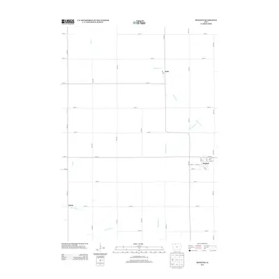
2013 Map of Ringsted
USGS Topo · Published 2013About this map
Ringsted serves as the primary hub of this northern Iowa landscape, situated in the southeast corner of the quadrangle. The town's grid is clearly defined by residential streets like Maple St and Emmet St, reflecting the typical organized growth of prairie rail and road settlements. Surrounding this central community, the terrain is shaped by an extensive network of drainage infrastructure, such as Ditch Number 37 and Ditch Number 21, which were essential for converting the low-lying wetlands of Emmet County into productive farmland. Smaller locales like Halfa and Hoprig mark the peripheral crossroads of this agricultural district, connected by a rigid system of section-line roads. The natural hydrology of Black Cat Cr and Jack Cr meanders through the landscape, contrasting with the straight-line human engineering of the drainage ditches that define the modern era of land management here.
Find a feature on this map
33 named features on this map. Tap any name to fly to it.
Don’t see what you’re looking for? This feature index may not catch every label — zoom into the map to look around manually.
Map Details
Editions of this 2013 Ringsted Map
This is the sole edition of this map. No revisions or reprints were ever made.
Other maps of this area

1954 · Fairmont
USGS Topo · 1:250,000

1958 · Fairmont
USGS Topo · 1:250,000

1980 · Fenton
USGS Topo · 1:24,000

1980 · Depew
USGS Topo · 1:24,000

1980 · Seneca
USGS Topo · 1:24,000

1980 · Armstrong
USGS Topo · 1:24,000

1980 · Ringsted
USGS Topo · 1:24,000

1980 · Ingham Lake
USGS Topo · 1:24,000

1980 · Gruver
USGS Topo · 1:24,000

1980 · Graettinger East
USGS Topo · 1:24,000