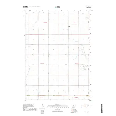
2018 Map of Ringsted
USGS Topo · Published 2018About this map
Ringsted stands as the primary hub in this corner of Emmet County, characterized by its traditional Midwestern grid and the junction of local routes like Heritage St and W Maple St. The surrounding landscape is defined by the engineered precision of early 21st-century agricultural drainage, where natural watercourses like Black Cat Cr and Jack Cr are supplemented by a network of numbered channels including Ditch Number 37 and Ditch Number 21. This 2018 survey reveals the persistent structure of the Public Land Survey System, with roads such as 250th St and 270th St tracing the section lines that have governed Iowa farming for generations. To the north, the small settlement of Halfa remains a quiet marker of the region's rural history, situated along the path of Co Hwy A33 amidst the open prairie and cultivated fields of the Des Moines Lobe.
Find a feature on this map
27 named features on this map. Tap any name to fly to it.
Don’t see what you’re looking for? This feature index may not catch every label — zoom into the map to look around manually.
Map Details
Editions of this 2018 Ringsted Map
This is the sole edition of this map. No revisions or reprints were ever made.
Other maps of this area

1954 · Fairmont
USGS Topo · 1:250,000

1958 · Fairmont
USGS Topo · 1:250,000

1980 · Fenton
USGS Topo · 1:24,000

1980 · Depew
USGS Topo · 1:24,000

1980 · Seneca
USGS Topo · 1:24,000

1980 · Armstrong
USGS Topo · 1:24,000

1980 · Ringsted
USGS Topo · 1:24,000

1980 · Ingham Lake
USGS Topo · 1:24,000

1980 · Gruver
USGS Topo · 1:24,000

1980 · Graettinger East
USGS Topo · 1:24,000