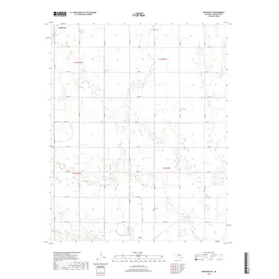
2018 Map of Ringwood SW
USGS Topo · Published 2018About this map
Ringwood and Ames anchor this Major County landscape, where the agricultural grid of the southern Plains meets the winding drainage of Hoyle Cr. The map reveals a deeply rooted rural community structure, defined by a network of sectional roads and small family or community cemeteries such as Era Cem, Glenwood Cem, and Concord Cem. These burial grounds, often the only remaining markers of earlier settlement clusters, are situated along the transit lines that connect the dispersed farms to the small town centers.
Find a feature on this map
31 named features on this map. Tap any name to fly to it.
Don’t see what you’re looking for? This feature index may not catch every label — zoom into the map to look around manually.
Map Details
Editions of this 2018 Ringwood SW Map
This is the sole edition of this map. No revisions or reprints were ever made.
Other maps of this area

1893 · Ames
USGS Topo · 1:62,500

1955 · Woodward
USGS Topo · 1:250,000

1956 · Ames
USGS Topo · 1:62,500

1956 · Ringwood
USGS Topo · 1:62,500

1958 · Woodward
USGS Topo · 1:250,000

1969 · Fairview NE
USGS Topo · 1:24,000

1969 · Fairview SE
USGS Topo · 1:24,000
1972 · Isabella
USGS Topo · 1:24,000
1982 · Ringwood
USGS Topo · 1:24,000
1982 · Barr
USGS Topo · 1:24,000