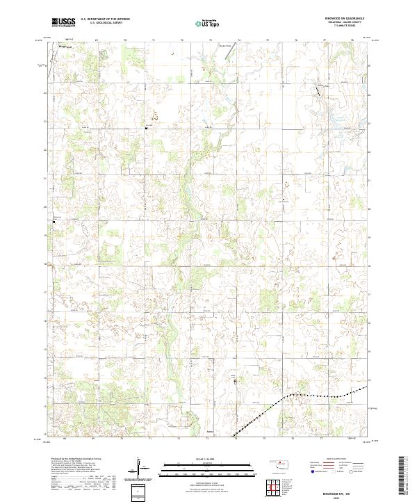
2022 Map of Ringwood SW
USGS Topo · Published 2022About this map
The northern edge of Ames and the southern limits of Ringwood anchor this section of Major County, where the landscape is defined by the winding course of Hoyle Cr and its associated wetlands. This survey highlights the rural character of the region, emphasizing a grid of section roads like n2700 RD and e0480 RD that partition the prairie into agricultural and resource-rich tracts. The presence of Decker Field and Johnson Field indicates the local importance of energy production within the broader plains economy.
Find a feature on this map
32 named features on this map. Tap any name to fly to it.
Don’t see what you’re looking for? This feature index may not catch every label — zoom into the map to look around manually.
Map Details
Editions of this 2022 Ringwood SW Map
This is the sole edition of this map. No revisions or reprints were ever made.
Other maps of this area

1893 · Ames
USGS Topo · 1:62,500

1955 · Woodward
USGS Topo · 1:250,000

1956 · Ames
USGS Topo · 1:62,500

1956 · Ringwood
USGS Topo · 1:62,500

1958 · Woodward
USGS Topo · 1:250,000

1969 · Fairview NE
USGS Topo · 1:24,000

1969 · Fairview SE
USGS Topo · 1:24,000
1972 · Isabella
USGS Topo · 1:24,000
1982 · Ringwood
USGS Topo · 1:24,000
1982 · Barr
USGS Topo · 1:24,000