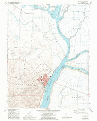
1978 Map of Rio Vista
USGS Topo · Published 1993About this map
The Sacramento River anchors this 1970s landscape, serving as a critical artery for the Deep Water Ship Channel and various agricultural tracts. The city of Rio Vista sits at the base of the Montezuma Hills, where the transition from rolling terrain to the low-lying delta is starkly defined by the Cache Slough and various bypass areas. This era shows a complex hydraulic landscape of pumping stations, siphons, and ferries necessary to manage the fertile but vulnerable lands of Ryer Island and Brannan Island.
Find a feature on this map
36 named features on this map. Tap any name to fly to it.
Don’t see what you’re looking for? This feature index may not catch every label — zoom into the map to look around manually.
Map Details
Editions of this 1978 Rio Vista Map
3 editions found
Other maps of this area

1907 · Antioch
USGS Topo · 1:62,500

1908 · Vacaville
USGS Topo · 1:62,500

1908 · Courtland
USGS Topo · 1:62,500

1908 · Antioch
USGS Topo · 1:62,500

1910 · Rio Vista
USGS Topo · 1:31,680

1910 · Bouldin
USGS Topo · 1:31,680

1910 · Jersey
USGS Topo · 1:31,680

1910 · Isleton
USGS Topo · 1:31,680

1916 · Cache Slough
USGS Topo · 1:31,680

1916 · Vorden
USGS Topo · 1:31,680