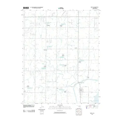
2009 Map of Ripley
USGS Topo · Published 2009About this map
The town of Ripley sits at the confluence of the Cimarron River and Stillwater Creek, serving as a focal point for this landscape in the late 2000s. The map reveals an extensive system of flood control and water management, evidenced by numerous numbered impoundments such as Stillwater Creek Site 1 Reservoir and Stillwater Creek Site 56 Reservoir, each accompanied by its respective dam. This infrastructure is interspersed with rural landmarks and family-history sites, including Mount Hope Cemetery, Clayton Cemetery, and Glenwood Cemetery. Transport through the river bottom is facilitated by the Allen Williamson Bridge, while the southeastern corner is dominated by the waters of Cushing Lake. To the east of the main creek, the terrain includes the interestingly named Ghost Hollow, providing a glimpse into the local nomenclature of this part of Oklahoma.
Find a feature on this map
54 named features on this map. Tap any name to fly to it.
Don’t see what you’re looking for? This feature index may not catch every label — zoom into the map to look around manually.
Map Details
Editions of this 2009 Ripley Map
This is the sole edition of this map. No revisions or reprints were ever made.
Other maps of this area

1893 · Stillwater
USGS Topo · 1:62,500

1908 · Agra
USGS Topo · 1:62,500

1909 · Perkins
USGS Topo · 1:62,500

1929 · Ripley
USGS Topo · 1:62,500

1932 · Ripley
USGS Topo · 1:62,500

1954 · Oklahoma City
USGS Topo · 1:250,000

1955 · Enid
USGS Topo · 1:250,000

1957 · Oklahoma City
USGS Topo · 1:250,000

1958 · Enid
USGS Topo · 1:250,000

1963 · Oklahoma City
USGS Topo · 1:250,000