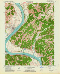
1961 Map of Rising Sun
USGS Topo · Published 1963About this map
The Ohio River forms a sweeping oxbow through this borderland, where the fertile floodplains of Upper East Bend Bottom, Lower East Bend Bottom, and Mexico Bottom meet the rising ridges of Randolph and Posey townships. On the Indiana side, the town of Rising Sun serves as a local hub, featuring the Rising Sun School and several Sand and Gravel Pits along the riverbanks. Across the water in Kentucky, the legendary landing at Rabbit Hash and the hamlet of Big Bone provide a window into the rural life of the early 1960s.
Find a feature on this map
57 named features on this map. Tap any name to fly to it.
Don’t see what you’re looking for? This feature index may not catch every label — zoom into the map to look around manually.
Map Details
Editions of this 1961 Rising Sun Map
2 editions found
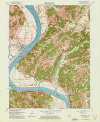
Other maps of this area

1914 · West Cincinnati
USGS Topo · 1:62,500

1915 · Lawrenceburg
USGS Topo · 1:48,000

1928 · Lawrenceburg
USGS Topo · 1:62,500

1932 · Lawrenceburg
USGS Topo · 1:62,500

1943 · Florence
USGS Topo · 1:24,000

1943 · Aberdeen
USGS Topo · 1:24,000

1943 · Aurora
USGS Topo · 1:24,000

1943 · Rising Sun
USGS Topo · 1:24,000

1943 · Lawrenceburg
USGS Topo · 1:24,000

1943 · Patriot
USGS Topo · 1:24,000