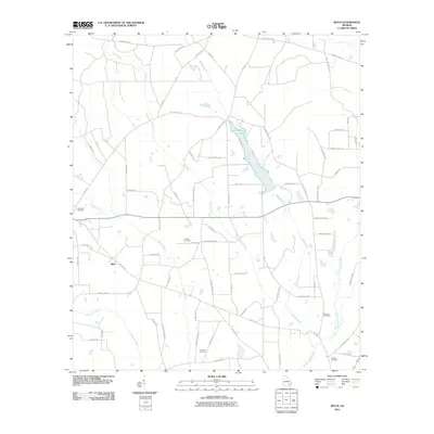
2011 Map of Ritch
USGS Topo · Published 2011About this map
Ritch and its rural surroundings in Wayne County are defined by a network of slow-moving waterways and established family burying grounds. The landscape is carved by the southern reach of Little Satilla Creek and the long, winding path of Dry Creek, which feeds into the prominent Lake Lindsay Grace. This water system supported the agrarian development of the region, evident in the numerous named access roads like Odum Ritch Rd and Empire School Rd. For local historians and genealogists, the map provides precise locations for several community landmarks including the Old Ritch Cemetery, Smiths Cemetery, and Thornton Cemetery. The arrangement of these sites alongside historical corridors like Holmesville Rd reflects the settlement patterns of this corner of Georgia, where life was historically centered around the intersection of small-scale farming and the tributary systems of the Satilla river basin.
Find a feature on this map
68 named features on this map. Tap any name to fly to it.
Don’t see what you’re looking for? This feature index may not catch every label — zoom into the map to look around manually.
Map Details
Editions of this 2011 Ritch Map
This is the sole edition of this map. No revisions or reprints were ever made.
Other maps of this area

1918 · Jesup
USGS Topo · 1:62,500

1918 · Hortense
USGS Topo · 1:62,500

1943 · Jesup
USGS Topo · 1:62,500

1944 · Hortense
USGS Topo · 1:62,500

1946 · Brunswick
USGS Topo · 1:250,000

1948 · Brunswick
USGS Topo · 1:250,000

1953 · Waycross
USGS Topo · 1:250,000

1956 · Brunswick
USGS Topo · 1:250,000

1958 · Waycross
USGS Topo · 1:250,000

1961 · Brunswick
USGS Topo · 1:250,000