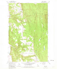
1965 Map of Ritz
USGS Topo · Published 1981About this map
The Great Northern railroad corridor defines the western edge of this Northern Idaho landscape, serving industrial stops like De Voignes Spur, Watson Spur, and the settlement of Ritz. In the mid-1960s, this area of Boundary County supported a mix of timber, mining, and rural community life within the Kaniksu National Forest. Local infrastructure is anchored by the Deer Park Community Hall and a system of logging and access routes including Fawn Lane Road and King Row Road.
Find a feature on this map
34 named features on this map. Tap any name to fly to it.
Don’t see what you’re looking for? This feature index may not catch every label — zoom into the map to look around manually.
Map Details
Editions of this 1965 Ritz Map
3 editions found
Other maps of this area

1911 · Priest Lake
USGS Topo · 1:250,000

1913 · Priest Lake
USGS Topo · 1:250,000

1958 · Sandpoint
USGS Topo · 1:250,000

1963 · Sandpoint
USGS Topo · 1:250,000

1965 · Meadow Creek
USGS Topo · 1:24,000

1965 · Farnham Peak
USGS Topo · 1:24,000

1965 · Eastport
USGS Topo · 1:24,000

1965 · Moravia
USGS Topo · 1:24,000

1965 · Ritz
USGS Topo · 1:24,000

1965 · Copeland
USGS Topo · 1:24,000