2024 Map of River Forest
USGS Topo · Published 2024About this map
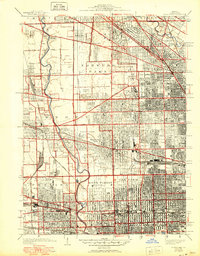
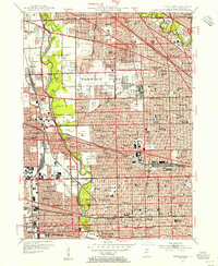
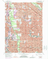
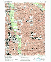
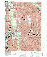
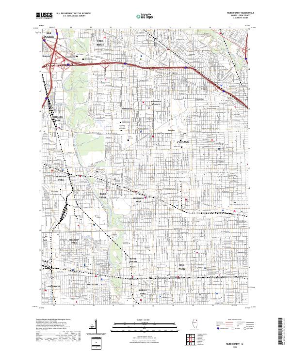
The Des Plaines River corridor serves as the primary geographic spine for this densely developed portion of Cook County, where historic cemeteries and educational institutions define the urban landscape. This survey details a sequence of massive memorial grounds including Westlawn Cem and Mausoleum, Acacia Park Cem and Mausoleum, and Concordia Cem, which offer significant data for genealogical research. The region's academic character is anchored by Dominican University and Concordia University Chicago in River Forest, alongside Triton College in River Grove. Smaller waterways like Crystal Creek and Addison Creek weave through established residential grids, while Schiller Pond provides a rare open-water feature within the suburban environment. The map effectively traces the transition between the city limits of Chicago and the independent municipalities of Park Ridge, Norridge, and Melrose Park.
Find a feature on this map
61 named features on this map. Tap any name to fly to it.
Don’t see what you’re looking for? This feature index may not catch every label — zoom into the map to look around manually.
Map Details
Editions of this 2024 River Forest Map
This is the sole edition of this map. No revisions or reprints were ever made.
Historical Maps of Harwood Heights Through Time
6 maps found