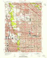
1953 Map of River Forest
USGS Topo · Published 1955About this map
The Des Plaines River corridor serves as the primary greenbelt for these established Chicago suburbs during the mid-century period. Within the La Framboise Reserve, expansive recreational spaces like the Indian Boundary Golf Course and Schiller Woods separate the residential grids of River Grove and Schiller Park. This era is defined by significant institutional and social infrastructure, seen in the presence of the Chicago State Hospital and Wright Jr College, alongside a high density of parochial schools such as St Paul Sch and St Giles Sch.
Find a feature on this map
152 named features on this map. Tap any name to fly to it.
Don’t see what you’re looking for? This feature index may not catch every label — zoom into the map to look around manually.
Map Details
Editions of this 1953 River Forest Map
This is the sole edition of this map. No revisions or reprints were ever made.
Other maps of this area

1889 · Chicago
USGS Topo · 1:62,500

1891 · Chicago
USGS Topo · 1:62,500

1891 · Riverside
USGS Topo · 1:62,500

1893 · Riverside
USGS Topo · 1:62,500

1899 · Evanston
USGS Topo · 1:62,500

1900 · Chicago
USGS Topo · 1:62,500

1900 · Riverside
USGS Topo · 1:62,500

1900 · Highwood
USGS Topo · 1:62,500

1901 · Riverside
USGS Topo · 1:62,500

1901 · Chicago
USGS Topo · 1:62,500