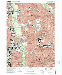
1997 Map of River Forest
USGS Topo · Published 1999About this map
The Des Plaines River corridor serves as the central spine for this late-20th-century landscape, separating the dense residential grids of Chicago from the western suburbs. This era reflects a fully developed urban-suburban interface where massive green spaces like Robinson Woods North and Schiller Woods South provide a stark contrast to the nearby industrial and commercial centers. The map detail highlights a significant concentration of institutional and memorial land use, particularly the cluster of large burial grounds including Westlawn Cemetery and Acacia Park Cemetery.
Find a feature on this map
259 named features on this map. Tap any name to fly to it.
Don’t see what you’re looking for? This feature index may not catch every label — zoom into the map to look around manually.
Map Details
Editions of this 1997 River Forest Map
This is the sole edition of this map. No revisions or reprints were ever made.
Other maps of this area

1889 · Chicago
USGS Topo · 1:62,500

1891 · Chicago
USGS Topo · 1:62,500

1891 · Riverside
USGS Topo · 1:62,500

1893 · Riverside
USGS Topo · 1:62,500

1899 · Evanston
USGS Topo · 1:62,500

1900 · Chicago
USGS Topo · 1:62,500

1900 · Riverside
USGS Topo · 1:62,500

1900 · Highwood
USGS Topo · 1:62,500

1901 · Riverside
USGS Topo · 1:62,500

1901 · Chicago
USGS Topo · 1:62,500