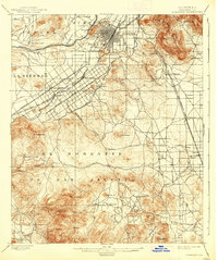
1901 Map of Riverside
USGS Topo · Published 1939About this map
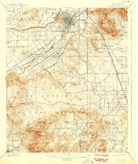
The Santa Ana River carves through this late nineteenth-century landscape, where the early agricultural and industrial foundation of Riverside is clearly visible. The intensive engineering required for citrus cultivation is documented by the presence of the Gage Canal and the Riverside Water Co. Canal, which snake across the plains south of Riverside. This network of water management allowed for the growth of communities like Arlington and Arlington Place, connected by the grand thoroughfares of Magnolia Avenue and Victoria Avenue.
Find a feature on this map
53 named features on this map. Tap any name to fly to it.
Don’t see what you’re looking for? This feature index may not catch every label — zoom into the map to look around manually.
Map Details
Editions of this 1901 Riverside Map
6 editions found
Other maps of this area

1896 · San Bernardino
USGS Topo · 1:62,500

1897 · Cucamonga
USGS Topo · 1:62,500

1898 · San Bernardino
USGS Topo · 1:62,500

1899 · Redlands
USGS Topo · 1:62,500

1900 · Cucamonga
USGS Topo · 1:62,500

1901 · Southern California Sheet No. 1
USGS Topo · 1:250,000

1901 · San Bernardino
USGS Topo · 1:62,500

1901 · Redlands
USGS Topo · 1:62,500

1901 · Elsinore
USGS Topo · 1:125,000

1901 · Riverside
USGS Topo · 1:62,500