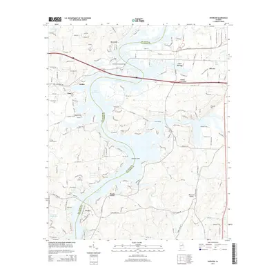
2014 Map of Riverside
USGS Topo · Published 2014About this map
The Coosa River defines the landscape of this region, with its waters widening into the expansive Logan Martin Lake. This survey illustrates the intricate relationship between the river and the various settlements along its banks, including Riverside, Seddon, and Stemley. The topography is marked by significant crossings such as the John Hollis Bankhead Bridge and the Eureka Bridge, which connect the communities divided by the water. To the east, Ragland Mtn rises above Howells Cove, providing a distinct contrast to the low-lying riverbanks.
Find a feature on this map
45 named features on this map. Tap any name to fly to it.
Don’t see what you’re looking for? This feature index may not catch every label — zoom into the map to look around manually.
Map Details
Editions of this 2014 Riverside Map
This is the sole edition of this map. No revisions or reprints were ever made.
Other maps of this area

1889 · Springville
USGS Topo · 1:125,000

1890 · Talladega
USGS Topo · 1:125,000

1892 · Springville
USGS Topo · 1:125,000

1892 · Talladega
USGS Topo · 1:125,000

1943 · Talladega
USGS Topo · 1:62,500

1946 · Talladega
USGS Topo · 1:62,500

1947 · Eastaboga
USGS Topo · 1:24,000

1947 · Ragland
USGS Topo · 1:62,500

1947 · Ragland
USGS Topo · 1:24,000

1947 · Riverside
USGS Topo · 1:24,000