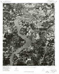
1975 Map of Riverside
USGS Topo · Published 1977About this map
Logan Martin Lake dominates this mid-1970s orthophoto, its sprawling fingers and inlets creating a complex shoreline throughout the center of the sheet. The settlement of Riverside occupies the northern banks, situated where major transportation corridors bridge the water. This orthophotoquad provides a clear visual record of the land use patterns during this era, showing the contrast between the dense wooded areas and the cleared agricultural fields or residential developments along the water’s edge. The imagery captures the physical landscape just a few years after the reservoir's creation, revealing how the rising waters reshaped the local topography around Riverside. Researchers can examine the visible road networks and the way the community oriented itself toward the new lakefront economy.
Find a feature on this map
2 named features on this map. Tap any name to fly to it.
Don’t see what you’re looking for? This feature index may not catch every label — zoom into the map to look around manually.
Map Details
Editions of this 1975 Riverside Map
This is the sole edition of this map. No revisions or reprints were ever made.
Other maps of this area

1889 · Springville
USGS Topo · 1:125,000

1890 · Talladega
USGS Topo · 1:125,000

1892 · Springville
USGS Topo · 1:125,000

1892 · Talladega
USGS Topo · 1:125,000

1943 · Talladega
USGS Topo · 1:62,500

1946 · Talladega
USGS Topo · 1:62,500

1947 · Eastaboga
USGS Topo · 1:24,000

1947 · Ragland
USGS Topo · 1:62,500

1947 · Ragland
USGS Topo · 1:24,000

1947 · Riverside
USGS Topo · 1:24,000