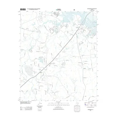
2013 Map of Riverside
USGS Topo · Published 2013About this map
Riverside serves as a focal point where the Union Pacific railroad corridor meets the sprawling waters of Livingston Reservoir in Walker County. This 2013 survey illustrates a landscape defined by its waterways, from the broad expanse of the reservoir to the winding paths of Harmon Cr and Caney Cr. Notable local landmarks include the Riverside Swinging Bridge and various rural centers like Arizona and Carolina. For those researching local heritage, the map identifies several burial grounds such as St Olive Cemetery, Pat Henry Cemetery, and Dodge Cem, alongside the Sterling Chapel church. The area's recreational and agricultural character is evident in the inclusion of Camp Alice, Eastham and Thomason Ranches Lake, and the numerous small lakes like Styles Lake 1 and Horseshoe Lake Number 2.
Find a feature on this map
152 named features on this map. Tap any name to fly to it.
Don’t see what you’re looking for? This feature index may not catch every label — zoom into the map to look around manually.
Map Details
Editions of this 2013 Riverside Map
This is the sole edition of this map. No revisions or reprints were ever made.
Other maps of this area

1954 · Beaumont
USGS Topo · 1:250,000

1957 · Beaumont
USGS Topo · 1:250,000

1960 · Trinity West
USGS Topo · 1:24,000

1960 · Trinity East
USGS Topo · 1:24,000

1960 · Phelps
USGS Topo · 1:24,000

1961 · Staley
USGS Topo · 1:24,000

1961 · Riverside
USGS Topo · 1:24,000

1961 · Oakhurst
USGS Topo · 1:24,000

1962 · Pine Prairie
USGS Topo · 1:24,000

1962 · Wyser Bottom
USGS Topo · 1:24,000