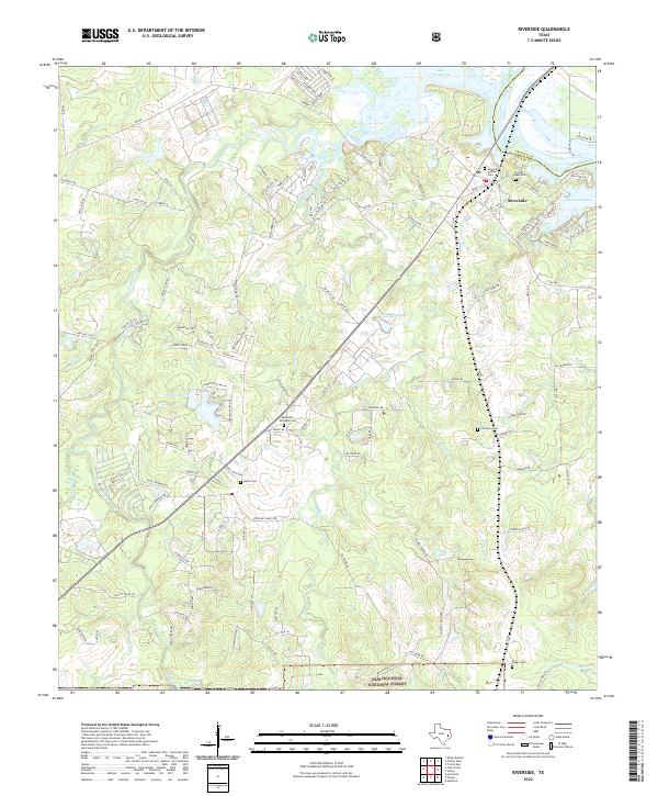
2022 Map of Riverside
USGS Topo · Published 2022About this map
Riverside sits at the northern edge of the Sam Houston National Forest where the Trinity River flows into the vast expanse of Lake Livingston. This 2022 survey captures the modern landscape of Walker County, highlighting the transition from the protected forestlands in the south to the developed water-frontage of the Trinity River basin. Genealogists will find several notable burial sites throughout the area, including the Riverside Pioneer Cem near the town center and the McMillian-McCaskill Cem further inland. The map details a complex network of creeks and bayous, such as Harmon Creek and Caney Cr, which feed into the regional river systems. These waterways, along with features like Mud Lake and Styles Lake, define the local topography and historical settlement patterns that remain visible even as the region grows.
Find a feature on this map
122 named features on this map. Tap any name to fly to it.
Don’t see what you’re looking for? This feature index may not catch every label — zoom into the map to look around manually.
Map Details
Editions of this 2022 Riverside Map
This is the sole edition of this map. No revisions or reprints were ever made.
Other maps of this area

1954 · Beaumont
USGS Topo · 1:250,000

1957 · Beaumont
USGS Topo · 1:250,000

1960 · Trinity West
USGS Topo · 1:24,000

1960 · Trinity East
USGS Topo · 1:24,000

1960 · Phelps
USGS Topo · 1:24,000

1961 · Staley
USGS Topo · 1:24,000

1961 · Riverside
USGS Topo · 1:24,000

1961 · Oakhurst
USGS Topo · 1:24,000

1962 · Pine Prairie
USGS Topo · 1:24,000

1962 · Wyser Bottom
USGS Topo · 1:24,000