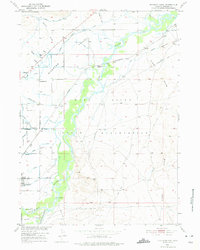
1950 Map of Riverton East
USGS Topo · Published 1975About this map
The Wind River Indian Reservation dominates this landscape, where the confluence of the Wind River and Little Wind River shaped the early development of Fremont County. By 1950, a complex system of irrigation infrastructure including the Wyoming Central Canal and Riverton No 2 Canal had transformed the arid terrain into productive land. The railroad's influence is clear along the Northwestern Line, which served localized agriculture at Farmers Siding.
Find a feature on this map
41 named features on this map. Tap any name to fly to it.
Don’t see what you’re looking for? This feature index may not catch every label — zoom into the map to look around manually.
Map Details
Editions of this 1950 Riverton East Map
3 editions found
Other maps of this area

1950 · Riverton East
USGS Topo · 1:24,000

1951 · Indian Butte
USGS Topo · 1:24,000

1951 · Hidden Valley
USGS Topo · 1:24,000

1951 · Riverton West
USGS Topo · 1:24,000

1952 · Riverton NE
USGS Topo · 1:24,000

1952 · Lost Wells Butte
USGS Topo · 1:24,000

1953 · Arapahoe NE
USGS Topo · 1:24,000

1953 · Arapahoe
USGS Topo · 1:24,000

1955 · Thermopolis
USGS Topo · 1:250,000

1955 · Lander
USGS Topo · 1:250,000