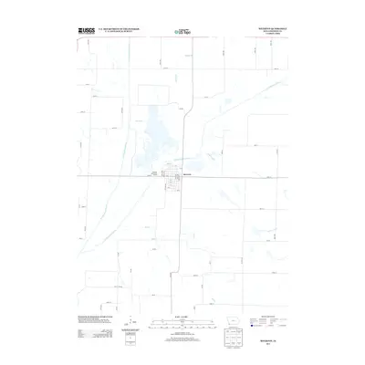
2013 Map of Riverton
USGS Topo · Published 2013About this map
Riverton occupies a central position on this Fremont County landscape, situated near the confluence where the W Nishnabotna River and E Nishnabotna River join. The town's grid is clearly defined by residential streets such as Apple Ave and Edith Ave, stretching toward the riverbanks. The surrounding terrain is defined by a network of drainage systems including Spring Br, Mill Cr, and Ledgewood Cr, which carve through the agricultural lands of southwestern Iowa. Water access is a primary feature of the local geography, specifically noted at the Riverton Boat Ramp Access. This 2013 survey provides a contemporary view of the region's rural road infrastructure, mapping out the precise intersections of local thoroughfares like 250th St and 330 Ave that connect the isolated farmsteads to the town center.
Find a feature on this map
56 named features on this map. Tap any name to fly to it.
Don’t see what you’re looking for? This feature index may not catch every label — zoom into the map to look around manually.
Map Details
Editions of this 2013 Riverton Map
This is the sole edition of this map. No revisions or reprints were ever made.
Other maps of this area

1939 · Farragut
USGS Topo · 1:62,500

1939 · Hamburg
USGS Topo · 1:62,500

1940 · Farragut
USGS Topo · 1:62,500

1941 · Hamburg
USGS Topo · 1:62,500

1955 · Nebraska City
USGS Topo · 1:250,000

1957 · Nebraska City
USGS Topo · 1:250,000

1957 · Randolph
USGS Topo · 1:24,000

1957 · Tabor SW
USGS Topo · 1:24,000

1958 · Nebraska City
USGS Topo · 1:250,000
1966 · Hamburg
USGS Topo · 1:24,000