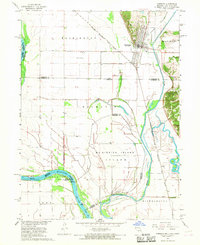
1966 Map of Hamburg
USGS Topo · Published 1968About this map
Hamburg sits at a geographic crossroads in the late 1960s, where the borders of Iowa, Missouri, and Nebraska converge. This survey by the Geological Survey illustrates a complex hydraulic landscape dominated by the Missouri River and the Nishnabotna River. The town is well-served by the Chicago Burlington and Quincy railroad, which threads through the river valley alongside the Iowa Drainage Ditch. Cultural landmarks like St Marys Ch and the Hamburg Cem are documented alongside local infrastructure such as the Hamburg Airport and a prominent Water Tank. To the south, the expansive Mc Kissick Island is defined by a dense network of drainage channels including High Creek Ditch, reflecting the era's intensive land management for agricultural use near the confluence of these major waterways.
Find a feature on this map
28 named features on this map. Tap any name to fly to it.
Don’t see what you’re looking for? This feature index may not catch every label — zoom into the map to look around manually.
Map Details
Editions of this 1966 Hamburg Map
2 editions found
Other maps of this area

1907 · Nebraska City
USGS Topo · 1:62,500

1915 · Nemaha
USGS Topo · 1:62,500

1915 · Howe
USGS Topo · 1:62,500

1939 · Hamburg
USGS Topo · 1:62,500

1939 · Nemaha
USGS Topo · 1:62,500

1941 · Hamburg
USGS Topo · 1:62,500

1949 · Nemaha
USGS Topo · 1:62,500

1955 · Nebraska City
USGS Topo · 1:250,000

1957 · Nebraska City
USGS Topo · 1:250,000

1958 · Nebraska City
USGS Topo · 1:250,000