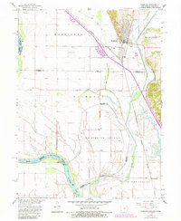
1966 Map of Hamburg
USGS Topo · Published 1984About this map
The town of Hamburg serves as the focal point for this survey where Iowa, Missouri, and Nebraska converge. Situated between the Missouri River and the Nishnabotna River, the landscape is defined by the complex water management of the Missouri River Basin. The presence of Main Ditch No 6 and the High Creek Ditch illustrates the extensive drainage efforts required to maintain the agricultural utility of Mc Kissick Island and surrounding lowlands.
Find a feature on this map
29 named features on this map. Tap any name to fly to it.
Don’t see what you’re looking for? This feature index may not catch every label — zoom into the map to look around manually.
Map Details
Editions of this 1966 Hamburg Map
2 editions found
Other maps of this area

1907 · Nebraska City
USGS Topo · 1:62,500

1915 · Nemaha
USGS Topo · 1:62,500

1915 · Howe
USGS Topo · 1:62,500

1939 · Hamburg
USGS Topo · 1:62,500

1939 · Nemaha
USGS Topo · 1:62,500

1941 · Hamburg
USGS Topo · 1:62,500

1949 · Nemaha
USGS Topo · 1:62,500

1955 · Nebraska City
USGS Topo · 1:250,000

1957 · Nebraska City
USGS Topo · 1:250,000

1958 · Nebraska City
USGS Topo · 1:250,000