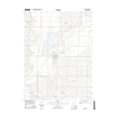
2015 Map of Riverton
USGS Topo · Published 2015About this map
The confluence of the West Nishnabotna River and East Nishnabotna River serves as the geographical centerpiece for this corner of Fremont County. The settlement of Riverton sits at this hydrologic junction, its residential blocks organized alphabetically from G St up to Q St. The surrounding landscape is defined by the broad floodplains and intricate wetlands created by these waterways, including the drainage of Spring Br and Mill Cr.
Find a feature on this map
64 named features on this map. Tap any name to fly to it.
Don’t see what you’re looking for? This feature index may not catch every label — zoom into the map to look around manually.
Map Details
Editions of this 2015 Riverton Map
This is the sole edition of this map. No revisions or reprints were ever made.
Other maps of this area

1939 · Farragut
USGS Topo · 1:62,500

1939 · Hamburg
USGS Topo · 1:62,500

1940 · Farragut
USGS Topo · 1:62,500

1941 · Hamburg
USGS Topo · 1:62,500

1955 · Nebraska City
USGS Topo · 1:250,000

1957 · Nebraska City
USGS Topo · 1:250,000

1957 · Randolph
USGS Topo · 1:24,000

1957 · Tabor SW
USGS Topo · 1:24,000

1958 · Nebraska City
USGS Topo · 1:250,000
1966 · Hamburg
USGS Topo · 1:24,000