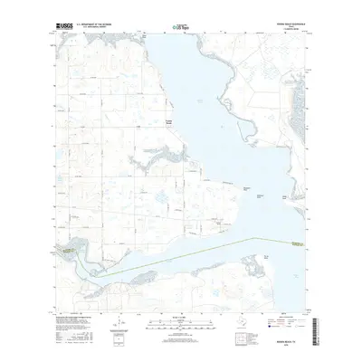
2016 Map of Riviera Beach
USGS Topo · Published 2016About this map
Loyola Beach and Riviera Beach overlook the waters of Cayo del Grullo in this coastal survey of South Texas. The landscape is defined by the irregular shoreline of the Baffin Bay complex, where the Kleberg Co and Kenedy Co line bisects the tidal flats of Laguna Salada. The area features a network of rural roads, such as Neubauer Point Rd, that provide access to points of land like Neubauer Point and Drum Point. To the west, the terrain transitions into a mosaic of small water bodies and drainage features, including Arana Cr, Hays Lake, and the expansive Laguna de Los Olmos. This map documents the intersection of agricultural road grids and the fragile marine environment of the Texas coast, preserving the 2016 footprint of these small waterfront communities and their surrounding marshes.
Find a feature on this map
53 named features on this map. Tap any name to fly to it.
Don’t see what you’re looking for? This feature index may not catch every label — zoom into the map to look around manually.
Map Details
Editions of this 2016 Riviera Beach Map
This is the sole edition of this map. No revisions or reprints were ever made.
Other maps of this area

1928 · Sarita
USGS Topo · 1:125,000

1950 · Corpus Christi
USGS Topo · 1:250,000

1951 · Kleberg Point
USGS Topo · 1:24,000

1951 · Riviera Beach NE
USGS Topo · 1:24,000

1951 · Sarita 4 NE
USGS Topo · 1:24,000

1952 · Riviera Beach
USGS Topo · 1:24,000

1952 · La Parra Ranch
USGS Topo · 1:24,000

1952 · Riviera Beach NW
USGS Topo · 1:24,000

1952 · Riviera Beach
USGS Topo · 1:62,500

1954 · Sarita
USGS Topo · 1:62,500