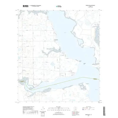
2019 Map of Riviera Beach
USGS Topo · Published 2019About this map
The coastal waters of Baffin Bay define this 2019 survey, where the brackish inlets of Cayo del Grullo and Laguna Salada intersect the shorelines of Kleberg and Kenedy counties. This landscape is characterized by its dynamic coastal features, including the prominent Neubauer Point and the shifting sands of Sandy Hook. The small settlement of Loyola Beach serves as a primary point of human activity along the northern inlet, connected to the interior by a network of farm-to-market roads like FM 628 and FM 771.
Find a feature on this map
55 named features on this map. Tap any name to fly to it.
Don’t see what you’re looking for? This feature index may not catch every label — zoom into the map to look around manually.
Map Details
Editions of this 2019 Riviera Beach Map
This is the sole edition of this map. No revisions or reprints were ever made.
Other maps of this area

1928 · Sarita
USGS Topo · 1:125,000

1950 · Corpus Christi
USGS Topo · 1:250,000

1951 · Kleberg Point
USGS Topo · 1:24,000

1951 · Riviera Beach NE
USGS Topo · 1:24,000

1951 · Sarita 4 NE
USGS Topo · 1:24,000

1952 · Riviera Beach
USGS Topo · 1:24,000

1952 · La Parra Ranch
USGS Topo · 1:24,000

1952 · Riviera Beach NW
USGS Topo · 1:24,000

1952 · Riviera Beach
USGS Topo · 1:62,500

1954 · Sarita
USGS Topo · 1:62,500