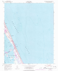
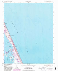
1953 Map of Roanoke Island NE
USGS Topo · Published 1977About this map
The shifting sands of the Outer Banks are meticulously documented in this mid-century survey, which reveals the transition between the Atlantic Ocean and the intricate marshes of Roanoke Sound. The landscape is dominated by dynamic coastal features, including Shifting Sand Dunes reaching heights of over fifty feet. Settlement is clustered at Nags Head and Whalebone, where development is constrained by the shoreline and the boundaries of the Cape Hatteras National Seashore. Marine infrastructure is vital here, with the U S Coast Guard Station and the Roanoke Sound Channel supporting navigation. A 1975 revision in purple highlights the evolving built environment along the Hatteras Telephone Line, including Jeanettes Pier and various local landmarks. Smaller islands like Big Penguin I and Headquarters Island dot the sound, while the Causeway provides a critical link westward.
Find a feature on this map
28 named features on this map. Tap any name to fly to it.
Don’t see what you’re looking for? This feature index may not catch every label — zoom into the map to look around manually.
Map Details
Editions of this 1953 Roanoke Island NE Map
6 editions found
Other maps of this area

1940 · Kitty Hawk
USGS Topo · 1:62,500

1943 · Roanoke Island
USGS Topo · 1:125,000

1946 · Eastville
USGS Topo · 1:250,000

1946 · Currituck Sound
USGS Topo · 1:250,000

1953 · Wanchese
USGS Topo · 1:24,000

1953 · Roanoke Island NE
USGS Topo · 1:24,000

1953 · Manteo
USGS Topo · 1:24,000

1955 · Wanchese
USGS Topo · 1:250,000

1957 · Manteo
USGS Topo · 1:250,000

1960 · Manteo
USGS Topo · 1:250,000