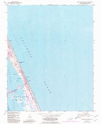
1953 Map of Roanoke Island NE
USGS Topo · Published 1980About this map
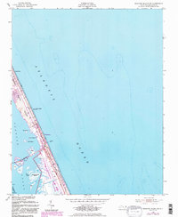
Bodie Island and the coastal landscape of Nags Head are documented here during a period of significant growth and preservation. This mid-century survey, with photorevisions from the 1970s, captures the establishment of the Cape Hatteras National Seashore as it surrounds the settlement of Whalebone. The mapping reveals the dynamic nature of the Outer Banks, noting various Shifting Sand Dunes and sound-side islands like Headquarters Island and Pond I. Inland navigation is detailed through the Roanoke Sound Channel and the Causeway, while the local economy and maritime presence are anchored by Jeanettes Pier and the U S Coast Guard Station. The presence of the Hatteras Telephone Road running parallel to the Atlantic shoreline highlights the early infrastructure required to connect these fragile barrier island communities.
Find a feature on this map
29 named features on this map. Tap any name to fly to it.
Don’t see what you’re looking for? This feature index may not catch every label — zoom into the map to look around manually.
Map Details
Editions of this 1953 Roanoke Island NE Map
6 editions found
Other maps of this area

1940 · Kitty Hawk
USGS Topo · 1:62,500

1943 · Roanoke Island
USGS Topo · 1:125,000

1946 · Eastville
USGS Topo · 1:250,000

1946 · Currituck Sound
USGS Topo · 1:250,000

1953 · Wanchese
USGS Topo · 1:24,000

1953 · Roanoke Island NE
USGS Topo · 1:24,000

1953 · Manteo
USGS Topo · 1:24,000

1955 · Wanchese
USGS Topo · 1:250,000

1957 · Manteo
USGS Topo · 1:250,000

1960 · Manteo
USGS Topo · 1:250,000