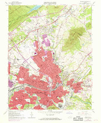
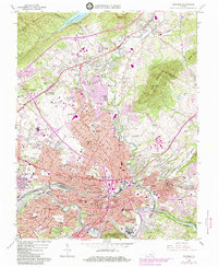
1963 Map of Roanoke
USGS Topo · Published 1969About this map
Hollins College stands as a focal point in the northern reach of this urbanizing landscape, situated just below the slopes of Tinker Mountain. The valley floor transitions from the established institutional grounds of the college toward the industrial and transport hubs of the City of Roanoke, where the Norfolk and Western railway lines converge. Substantial mid-century infrastructure is evident at the Roanoke Municipal Airport (Woodrum Field) and the Crossroads Mall Shopping Center, signaling a period of significant commercial expansion. Along the Roanoke River to the southeast, the Niagara Power Plant Dam reflects the utility requirements of a growing city. The map also records numerous local educational and spiritual landmarks, from William Byrd High Sch to several small family and community burial sites like Obenchain Cem and Tombstone Cem, providing a detailed record of the area's mid-1960s development.
Find a feature on this map
83 named features on this map. Tap any name to fly to it.
Don’t see what you’re looking for? This feature index may not catch every label — zoom into the map to look around manually.
Map Details
Editions of this 1963 Roanoke Map
6 editions found
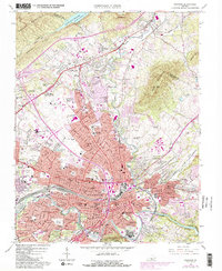
Other maps of this area

1890 · Roanoke
USGS Topo · 1:125,000

1890 · Christiansburg
USGS Topo · 1:125,000

1891 · Roanoke
USGS Topo · 1:125,000

1929 · Roanoke
USGS Topo · 1:48,000

1929 · Salem
USGS Topo · 1:48,000

1932 · Salem
USGS Topo · 1:62,500

1933 · Roanoke
USGS Topo · 1:62,500

1947 · Roanoke
USGS Topo · 1:250,000

1950 · Elliston
USGS Topo · 1:62,500

1951 · Boones Mill
USGS Topo · 1:62,500