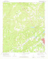
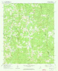
1969 Map of Roanoke West
USGS Topo · Published 1973About this map
Roanoke serves as the primary hub in this corner of Randolph County, where the Coast Line and Seaboard railroads converge. The landscape is defined by a dense network of rural churches and family-named landmarks, reflecting a deeply rooted community structure. From Rock Springs Ch in the north to Mission Mt Bethel Ch near the southern border, these small centers of assembly are often situated near the headwaters of local drainages like Cornhouse Creek and High Pine Creek. The presence of the Potash Lookout Tower and multiple radio towers suggests a terrain that, while punctuated by agriculture, remains focused on communication and timber management. Small settlements such as Rock Stand and Harmon Crossroads appear as quiet clusters along the winding secondary roads that connect the larger town of Roanoke to the surrounding hills and shoals.
Find a feature on this map
43 named features on this map. Tap any name to fly to it.
Don’t see what you’re looking for? This feature index may not catch every label — zoom into the map to look around manually.
Map Details
Editions of this 1969 Roanoke West Map
2 editions found
Other maps of this area

1891 · Ashland
USGS Topo · 1:125,000

1899 · Wedowee
USGS Topo · 1:125,000

1902 · Wedowee
USGS Topo · 1:125,000

1953 · Atlanta
USGS Topo · 1:250,000

1957 · Atlanta
USGS Topo · 1:250,000

1958 · Atlanta
USGS Topo · 1:250,000
1968 · Five Points
USGS Topo · 1:24,000
1969 · Roanoke East
USGS Topo · 1:24,000

1969 · Wadley North
USGS Topo · 1:24,000
1969 · Napoleon
USGS Topo · 1:24,000