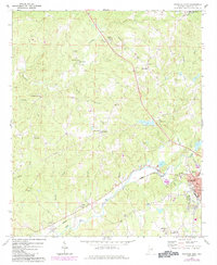
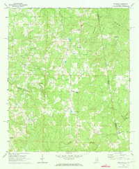
1969 Map of Roanoke West
USGS Topo · Published 1984About this map
The agricultural and community life of eastern Alabama is documented here through a dense network of small rural crossroads and congregational centers. Roanoke serves as the primary hub in the southeast, while smaller centers like Cornhouse and Rock Stand anchor the outlying farm country. The landscape is heavily defined by its drainage systems, with Cornhouse Creek and its many tributaries, such as Gaston Branch and Liles Branch, carving the terrain.
Find a feature on this map
44 named features on this map. Tap any name to fly to it.
Don’t see what you’re looking for? This feature index may not catch every label — zoom into the map to look around manually.
Map Details
Editions of this 1969 Roanoke West Map
2 editions found
Other maps of this area

1891 · Ashland
USGS Topo · 1:125,000

1899 · Wedowee
USGS Topo · 1:125,000

1902 · Wedowee
USGS Topo · 1:125,000

1953 · Atlanta
USGS Topo · 1:250,000

1957 · Atlanta
USGS Topo · 1:250,000

1958 · Atlanta
USGS Topo · 1:250,000
1968 · Five Points
USGS Topo · 1:24,000
1969 · Roanoke East
USGS Topo · 1:24,000

1969 · Wadley North
USGS Topo · 1:24,000
1969 · Napoleon
USGS Topo · 1:24,000