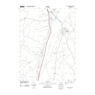
2010 Map of Roaring Spring
USGS Topo · Published 2010About this map
Roaring Spring and its surrounding communities in Blair County are documented here during the first decade of the 21st century. The topography is defined by the Frankstown Branch Juniata River and numerous tributaries like Halter Creek and Cabbage Creek, which carved the gaps and hollows that historically dictated settlement patterns. Small clusters such as East Freedom, Leamersville, and Claysburg are shown alongside smaller rural points like Friesville and Cotton Town.
Find a feature on this map
72 named features on this map. Tap any name to fly to it.
Don’t see what you’re looking for? This feature index may not catch every label — zoom into the map to look around manually.
Map Details
Editions of this 2010 Roaring Spring Map
This is the sole edition of this map. No revisions or reprints were ever made.
Other maps of this area

1900 · Everett
USGS Topo · 1:62,500

1902 · Everett
USGS Topo · 1:62,500

1902 · Ebensburg
USGS Topo · 1:62,500

1902 · Hollidaysburg
USGS Topo · 1:62,500

1903 · Hollidaysburg
USGS Topo · 1:62,500

1904 · Ebensburg
USGS Topo · 1:62,500

1908 · Bedford
USGS Topo · 1:62,500

1910 · Bedford
USGS Topo · 1:62,500

1953 · Pittsburgh
USGS Topo · 1:250,000

1954 · Pittsburgh
USGS Topo · 1:250,000
Featured Places
- Roaring Spring, PA
- Rodman, Taylor Township
- Friesville, Greenfield Township
- Bakers Summit, Bloomfield Township
- Smith Corner, Freedom Township