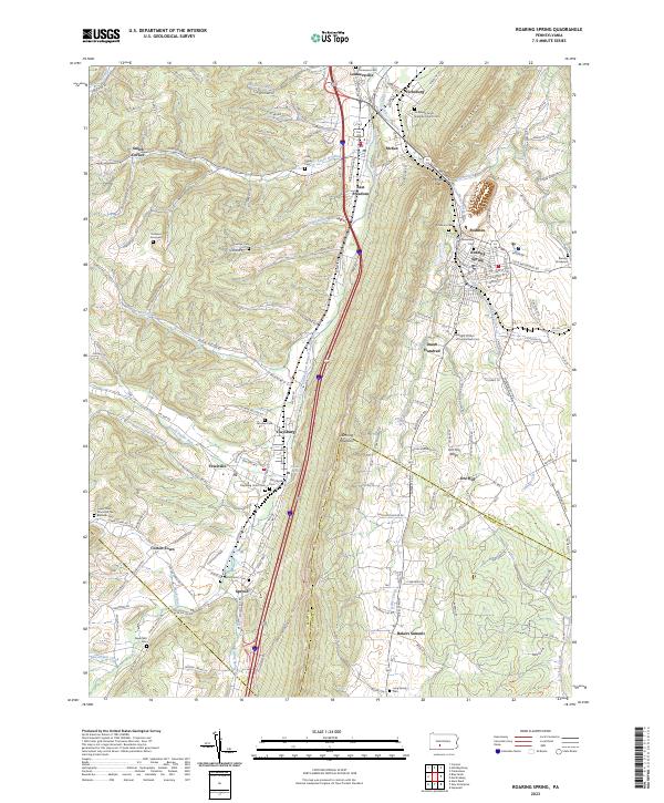
2023 Map of Roaring Spring
USGS Topo · Published 2023About this map
Dunning Mountain and Short Mountain frame a valley corridor in Blair County where industry and geography have long intersected. The town of Roaring Spring serves as a focal point, situated near McKee Gap where the Frankstown Branch Juniata River cuts through the ridgeline. This landscape is defined by its transit networks, including the Everett RR and the Old US Hwy 220 corridor, which connect a series of small settlements such as Claysburg, East Freedom, and Sproul.
Find a feature on this map
155 named features on this map. Tap any name to fly to it.
Don’t see what you’re looking for? This feature index may not catch every label — zoom into the map to look around manually.
Map Details
Editions of this 2023 Roaring Spring Map
This is the sole edition of this map. No revisions or reprints were ever made.
Other maps of this area

1900 · Everett
USGS Topo · 1:62,500

1902 · Everett
USGS Topo · 1:62,500

1902 · Ebensburg
USGS Topo · 1:62,500

1902 · Hollidaysburg
USGS Topo · 1:62,500

1903 · Hollidaysburg
USGS Topo · 1:62,500

1904 · Ebensburg
USGS Topo · 1:62,500

1908 · Bedford
USGS Topo · 1:62,500

1910 · Bedford
USGS Topo · 1:62,500

1953 · Pittsburgh
USGS Topo · 1:250,000

1954 · Pittsburgh
USGS Topo · 1:250,000