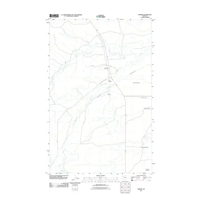
2011 Map of Robere
USGS Topo · Published 2011About this map
Robere (Historical) stands as a poignant landmark on this landscape, its memory preserved alongside the Robare Cemetery in this northern Montana survey. The terrain is defined by the vital irrigation infrastructure required for life on the Birch Creek Flats, with the Kingsbury Ditch, Thomas Williamson Ditch, and Ryan Lauffler Ditch cutting across the plains to distribute water from Birch Creek. This water management network, including the Birch Creek-Main Canal, illustrates the intensive agrarian engineering of the region. Local landmarks like the Birch Creek Rodeo Ground and the interestingly named Sober Up Coulee provide a glimpse into the community life and local nomenclature of Glacier County. The map also records the winding paths of Blacktail Creek and the deep draws of Miller Coulee and Cartwright Coulee.
Find a feature on this map
17 named features on this map. Tap any name to fly to it.
Don’t see what you’re looking for? This feature index may not catch every label — zoom into the map to look around manually.
Map Details
Editions of this 2011 Robere Map
This is the sole edition of this map. No revisions or reprints were ever made.
Other maps of this area

1914 · Heart Butte
USGS Topo · 1:125,000

1918 · Heart Butte
USGS Topo · 1:125,000

1920 · Dupuyer
USGS Topo · 1:125,000

1934 · Lake Frances
USGS Topo · 1:48,000

1936 · Pendroy
USGS Topo · 1:48,000

1937 · Lake Frances
USGS Topo · 1:62,500

1941 · Pendroy
USGS Topo · 1:62,500

1960 · Cut Bank
USGS Topo · 1:250,000

1963 · Cut Bank
USGS Topo · 1:250,000

1964 · Cut Bank
USGS Topo · 1:250,000