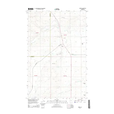
2014 Map of Robere
USGS Topo · Published 2014About this map
Robere (historical) and the nearby Robare Cem anchor this landscape along the border of Glacier and Pondera Counties. The topography is defined by an extensive network of irrigation canals and natural drainage patterns, where the waters of Birch Cr and Blacktail Cr are diverted into the Kingsbury Ditch, Thomas Williamson Ditch, and Cartwright Coulee Ditch. These man-made channels support the agricultural viability of the Birch Creek Flats, a flat expanse that contrasts with the localized relief of Miller Coulee and the uniquely named Sober Up Coulee. Transportation in this rural area follows a grid-like pattern of local routes such as Mollys Nipple Rd and Birch Creek Rd, all connecting to the primary north-south artery of Us-89 as it crosses the plains east of the Rockies.
Find a feature on this map
25 named features on this map. Tap any name to fly to it.
Don’t see what you’re looking for? This feature index may not catch every label — zoom into the map to look around manually.
Map Details
Editions of this 2014 Robere Map
This is the sole edition of this map. No revisions or reprints were ever made.
Other maps of this area

1914 · Heart Butte
USGS Topo · 1:125,000

1918 · Heart Butte
USGS Topo · 1:125,000

1920 · Dupuyer
USGS Topo · 1:125,000

1934 · Lake Frances
USGS Topo · 1:48,000

1936 · Pendroy
USGS Topo · 1:48,000

1937 · Lake Frances
USGS Topo · 1:62,500

1941 · Pendroy
USGS Topo · 1:62,500

1960 · Cut Bank
USGS Topo · 1:250,000

1963 · Cut Bank
USGS Topo · 1:250,000

1964 · Cut Bank
USGS Topo · 1:250,000