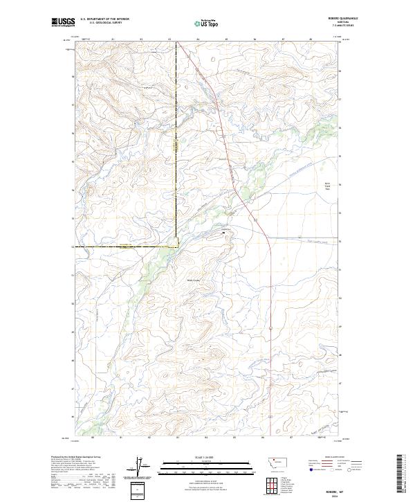
2024 Map of Robere
USGS Topo · Published 2024About this map
Birch Creek flows through the borderlands of Glacier and Pondera Counties, where an intricate network of irrigation channels like the Kingsbury Ditch and Thomas Williamson Ditch define the local agriculture. This landscape is marked by the historical path of the Lewis and Clark Trl, cutting through the plains toward the Birch Creek Flats. Near the center of the sheet, the Robare Cem stands as a quiet marker of the area's early settlement history.
Find a feature on this map
24 named features on this map. Tap any name to fly to it.
Don’t see what you’re looking for? This feature index may not catch every label — zoom into the map to look around manually.
Map Details
Editions of this 2024 Robere Map
This is the sole edition of this map. No revisions or reprints were ever made.
Other maps of this area

1914 · Heart Butte
USGS Topo · 1:125,000

1918 · Heart Butte
USGS Topo · 1:125,000

1920 · Dupuyer
USGS Topo · 1:125,000

1934 · Lake Frances
USGS Topo · 1:48,000

1936 · Pendroy
USGS Topo · 1:48,000

1937 · Lake Frances
USGS Topo · 1:62,500

1941 · Pendroy
USGS Topo · 1:62,500

1960 · Cut Bank
USGS Topo · 1:250,000

1963 · Cut Bank
USGS Topo · 1:250,000

1964 · Cut Bank
USGS Topo · 1:250,000