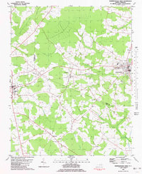
1981 Map of Robersonsville West
USGS Topo · Published 1981About this map
The Seaboard Coast Line railroad serves as the industrial spine of this landscape, connecting the junction town of Parmele with nearby Robersonville and Bethel. This 1981 survey illustrates the rural character of the eastern North Carolina coastal plain, where extensive wetland systems like Flat Swamp, Briery Swamp, and Tranters Creek dictate the layout of timberland and agriculture. Numerous small cemeteries are scattered across the territory, documenting the deep-rooted family history of the surrounding countryside. Cultural and community landmarks are clearly marked, including First Swamp Ch and Hickory Grove Ch, along with essential town services such as the Hospital and Athletic Field in Robersonville. The presence of a Drive-in Theater and a Golf Course reflects the mid-century recreational infrastructure of the region during a period of steady growth.
Find a feature on this map
28 named features on this map. Tap any name to fly to it.
Don’t see what you’re looking for? This feature index may not catch every label — zoom into the map to look around manually.
Map Details
Editions of this 1981 Robersonsville West Map
This is the sole edition of this map. No revisions or reprints were ever made.
Other maps of this area

1901 · Parmele
USGS Topo · 1:62,500

1901 · Williamston
USGS Topo · 1:62,500

1902 · Williamston
USGS Topo · 1:62,500

1902 · Parmele
USGS Topo · 1:62,500

1903 · Winterville
USGS Topo · 1:62,500

1903 · Chocowinity
USGS Topo · 1:62,500

1905 · Chocowinity
USGS Topo · 1:62,500

1905 · Winterville
USGS Topo · 1:62,500

1953 · Rocky Mount
USGS Topo · 1:250,000

1954 · Rocky Mount
USGS Topo · 1:250,000