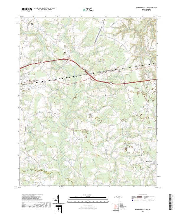
2022 Map of Robersonville East
USGS Topo · Published 2022About this map
Robersonville and Everetts anchor this section of eastern Martin County, where the landscape transitions from established town grids into the intricate drainage networks of the coastal plain. The eastern outskirts of Robersonville show a developing infrastructure of local streets like Joseph St and E Green St, while the surrounding terrain is defined by sprawling wetlands. The Huskanaw Swamp and Ross Swamp dominate the central geography, illustrating how the natural hydrology dictated the placement of agricultural tracts and transport corridors like Robersonville Products Rd. To the north, the Martin County Airport and the settlement of Gold Point mark the edges of this rural corridor. The map further documents the small community of Bear Grass and the southern marshlands of Turkey Swamp, providing a clear record of the intersection between historic farming settlements and the persistent wetlands of the region.
Find a feature on this map
91 named features on this map. Tap any name to fly to it.
Don’t see what you’re looking for? This feature index may not catch every label — zoom into the map to look around manually.
Map Details
Editions of this 2022 Robersonville East Map
This is the sole edition of this map. No revisions or reprints were ever made.
Other maps of this area

1901 · Parmele
USGS Topo · 1:62,500

1901 · Williamston
USGS Topo · 1:62,500

1902 · Williamston
USGS Topo · 1:62,500

1902 · Parmele
USGS Topo · 1:62,500

1903 · Winterville
USGS Topo · 1:62,500

1903 · Chocowinity
USGS Topo · 1:62,500

1905 · Chocowinity
USGS Topo · 1:62,500

1905 · Winterville
USGS Topo · 1:62,500

1953 · Rocky Mount
USGS Topo · 1:250,000

1954 · Rocky Mount
USGS Topo · 1:250,000