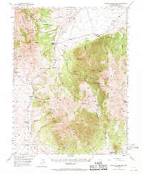
1949 Map of Roberts Creek Mtn
USGS Topo · Published 1970About this map
Indian Ranch and Tonkin Ranch anchor this post-war landscape of the high Great Basin, where early cattle and sheep operations followed the available water sources. The terrain is dominated by the Roberts Mountains and Simpson Park Mountains, with the prominent summit of Roberts Creek Mtn rising above Denay Valley. Life in this arid region centered on scattered springs such as Indian Spr, Tonkin Spr, and Black Spr, which supported both livestock and transient camps. Evidence of mineral exploration appears via a Prospect located near the Red Hills. The map shows a clear network of movement through the high desert, including passage through McClusky Pass and Tonkin Summit, connecting isolated hubs like Three Bar Ranch and Willow Creek Ranch to the broader Eureka County area during the mid-century period.
Find a feature on this map
40 named features on this map. Tap any name to fly to it.
Don’t see what you’re looking for? This feature index may not catch every label — zoom into the map to look around manually.
Map Details
Editions of this 1949 Roberts Creek Mtn Map
3 editions found
Other maps of this area

1926 · Roberts Mountains
USGS Topo · 1:250,000

1929 · Roberts Mountains
USGS Topo · 1:250,000

1937 · Mineral Hill
USGS Topo · 1:48,000

1938 · Cortez
USGS Topo · 1:48,000

1943 · Mineral Hill
USGS Topo · 1:62,500

1944 · Cortez
USGS Topo · 1:62,500

1949 · Garden Valley
USGS Topo · 1:62,500

1949 · Roberts Creek Mtn
USGS Topo · 1:62,500

1951 · Roberts Creek Mtn
USGS Topo · 1:62,500

1951 · Garden Valley
USGS Topo · 1:62,500