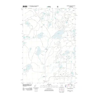
2011 Map of Roberts Lake
USGS Topo · Published 2011About this map
Lily River and its various branches, including the East Branch Lily River, weave through this densely lacustrine landscape of Forest County. The 2011 survey documents a region defined by its water resources, from the expansive Roberts Lake and Jungle Lake to smaller, distinct bodies such as Ground Hemlock Lake and Arbutus Lake. The presence of Pig Snout Siding suggests the area's historical connection to rail transport, while the Bog Brook 2WP1571 Dam indicates managed water levels on Bogbrook Lake. Small clusters of development appear at Woodlawn and Choate, centered around local thoroughfares like County Hwy DD and Woodlawn Rd. This map captures the modern footprint of these Northwoods communities, illustrating the dense network of private lake access roads like Maple Hts and N Shore Dr that serve seasonal and year-round residences.
Find a feature on this map
80 named features on this map. Tap any name to fly to it.
Don’t see what you’re looking for? This feature index may not catch every label — zoom into the map to look around manually.
Map Details
Editions of this 2011 Roberts Lake Map
This is the sole edition of this map. No revisions or reprints were ever made.
Other maps of this area

1939 · Crandon
USGS Topo · 1:48,000

1939 · Laona
USGS Topo · 1:48,000

1941 · Crandon
USGS Topo · 1:48,000

1942 · Wabeno
USGS Topo · 1:48,000

1942 · Pearson
USGS Topo · 1:48,000

1946 · Laona
USGS Topo · 1:48,000

1947 · Crandon
USGS Topo · 1:48,000

1950 · Wabeno
USGS Topo · 1:48,000

1950 · Lily
USGS Topo · 1:48,000

1951 · Wabeno
USGS Topo · 1:48,000