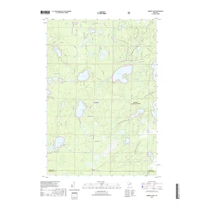
2018 Map of Roberts Lake
USGS Topo · Published 2018About this map
Nicolet National Forest dominates the landscape of this northern Wisconsin territory, where the borders of Forest and Langlade Counties meet. The region is defined by an intricate network of glacial lakes and wetlands, connected by the Lily River and tributaries like Bog Brook. Small settlements such as Woodlawn and Choate sit amidst a dense cluster of water bodies including Roberts Lake, Arbutus Lake, and the aptly named Jungle Lake. The map reveals a high concentration of recreational and residential development along the shorelines, evidenced by the numerous named roads like Arbutus Rd and Jungle Lake Rd that wind between the water's edge and the forest interior. This survey provides a clear view of the northwoods land use, balancing timber conservation with lakefront communities and natural features like O'Brien Springs.
Find a feature on this map
78 named features on this map. Tap any name to fly to it.
Don’t see what you’re looking for? This feature index may not catch every label — zoom into the map to look around manually.
Map Details
Editions of this 2018 Roberts Lake Map
This is the sole edition of this map. No revisions or reprints were ever made.
Other maps of this area

1939 · Crandon
USGS Topo · 1:48,000

1939 · Laona
USGS Topo · 1:48,000

1941 · Crandon
USGS Topo · 1:48,000

1942 · Wabeno
USGS Topo · 1:48,000

1942 · Pearson
USGS Topo · 1:48,000

1946 · Laona
USGS Topo · 1:48,000

1947 · Crandon
USGS Topo · 1:48,000

1950 · Wabeno
USGS Topo · 1:48,000

1950 · Lily
USGS Topo · 1:48,000

1951 · Wabeno
USGS Topo · 1:48,000