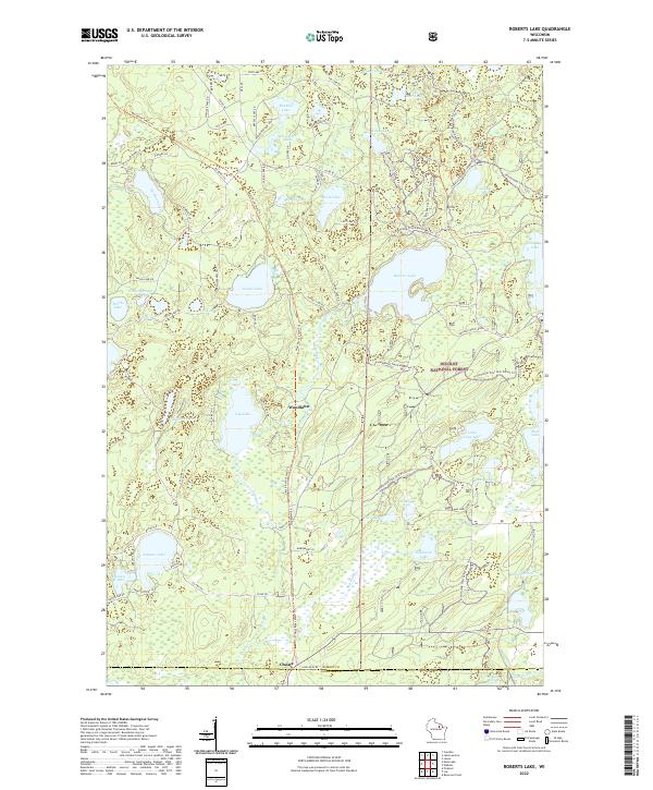
2022 Map of Roberts Lake
USGS Topo · Published 2022About this map
Nicolet National Forest dominates this northern Wisconsin landscape, where the headwaters of the Wolf River and Lily River carve through dense timberland. The area is defined by its glacial hydrology, featuring a high density of water bodies from the large central Roberts Lake to smaller, isolated pockets like Bogbrook Lake, Shoe Lake, and Mud Lake. Settlement patterns here are sparse and primarily tied to historical transit and recreation, represented by the small community at Woodlawn and the southern corner at Choate.
Find a feature on this map
91 named features on this map. Tap any name to fly to it.
Don’t see what you’re looking for? This feature index may not catch every label — zoom into the map to look around manually.
Map Details
Editions of this 2022 Roberts Lake Map
This is the sole edition of this map. No revisions or reprints were ever made.
Other maps of this area

1939 · Crandon
USGS Topo · 1:48,000

1939 · Laona
USGS Topo · 1:48,000

1941 · Crandon
USGS Topo · 1:48,000

1942 · Wabeno
USGS Topo · 1:48,000

1942 · Pearson
USGS Topo · 1:48,000

1946 · Laona
USGS Topo · 1:48,000

1947 · Crandon
USGS Topo · 1:48,000

1950 · Wabeno
USGS Topo · 1:48,000

1950 · Lily
USGS Topo · 1:48,000

1951 · Wabeno
USGS Topo · 1:48,000