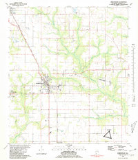
1980 Map of Robertsdale
USGS Topo · Published 1981About this map
The agricultural and transit corridor of central Baldwin County is anchored by Robertsdale, Silverhill, and Loxley during the early 1980s. The Louisville and Nashville railroad serves as the primary spine for these communities, running southeast through a landscape defined by creeks and timbered drainages. Notable military and aviation presence is marked by the OLF Summerdale US Naval Res and several landing strips, reflecting the region's importance to flight training. Local life is centered around family-named cemeteries and rural institutions like Rosinton Sch and Greenwood Ch. The transition from rural farmland to town centers is evident in the presence of the Drive-in Theater and the centralized Summerdale High Sch, while the outlying areas remain dominated by the wandering paths of Milk Creek and the Blackwater River.
Find a feature on this map
44 named features on this map. Tap any name to fly to it.
Don’t see what you’re looking for? This feature index may not catch every label — zoom into the map to look around manually.
Map Details
Editions of this 1980 Robertsdale Map
2 editions found
Other maps of this area

1920 · Robertsdale
USGS Topo · 1:62,500

1921 · Bon Secour
USGS Topo · 1:62,500

1921 · Point Clear
USGS Topo · 1:62,500

1921 · Fairhope
USGS Topo · 1:62,500

1940 · Silverhill
USGS Topo · 1:31,680

1941 · Silverhill
USGS Topo · 1:31,680

1941 · Robertsdale
USGS Topo · 1:62,500

1941 · Foley
USGS Topo · 1:62,500

1941 · Weeks Bay
USGS Topo · 1:62,500

1941 · Fairhope
USGS Topo · 1:62,500