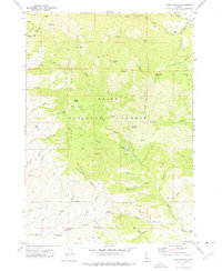
1972 Map of Robie Creek
USGS Topo · Published 1975About this map
Boise Ridge dominates this 1970s landscape, serving as a high-altitude spine that divides the drainage systems of the Boise National Forest. The map illustrates a transitional zone where recreation and extraction meet, characterized by a complex network of Pack Trails and Jeep Trails carving through the steep gulches of the Boise Front. High summits like Boise Peak and Gardiner Peak stand as prominent landmarks above the canyon-dissected terrain.
Find a feature on this map
52 named features on this map. Tap any name to fly to it.
Don’t see what you’re looking for? This feature index may not catch every label — zoom into the map to look around manually.
Map Details
Editions of this 1972 Robie Creek Map
2 editions found
Other maps of this area

1892 · Boise
USGS Topo · 1:125,000

1894 · Idaho Basin
USGS Topo · 1:125,000

1897 · Boise
USGS Topo · 1:125,000

1949 · Robie Creek
USGS Topo · 1:24,000

1954 · Boise South
USGS Topo · 1:24,000

1954 · Boise North
USGS Topo · 1:24,000

1954 · Boise
USGS Topo · 1:62,500

1955 · Hailey
USGS Topo · 1:250,000

1955 · Boise
USGS Topo · 1:250,000

1957 · Cartwright Canyon
USGS Topo · 1:24,000