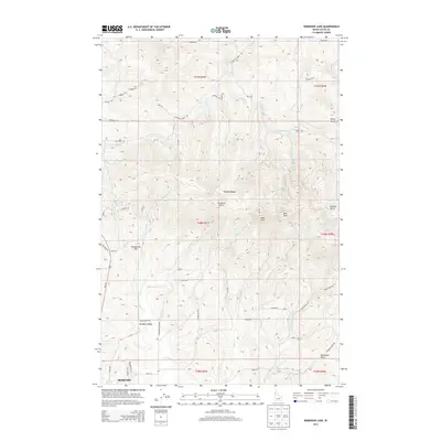
2013 Map of Robinson Lake
USGS Topo · Published 2013About this map
The northern reaches of Moscow and the agricultural expanse of Paradise Valley define this portrait of Latah County in the early 21st century. The map is dominated by the prominent peaks of the Palouse Range, including the distinctive summits of West Twin and East Twin. This terrain drops into the drainage basins of the S Fork Palouse River and several local creeks, such as Paradise Cr and Idlers Rest Cr. The layout of the land reflects a transition from the urban edge of Moscow to the high-elevation landmarks like Paradise Point and Granite Point. Local recreation and rural infrastructure are evident through the presence of Robinson Lake and Rowlands Park in the southeast. A dense network of county roads, such as Flannigan Creek Rd and Idlers Rest Rd, weaves through the foothills, providing access to established homesteads and the timbered slopes of the range.
Find a feature on this map
101 named features on this map. Tap any name to fly to it.
Don’t see what you’re looking for? This feature index may not catch every label — zoom into the map to look around manually.
Map Details
Editions of this 2013 Robinson Lake Map
This is the sole edition of this map. No revisions or reprints were ever made.
Other maps of this area

1910 · Pullman
USGS Topo · 1:125,000

1955 · Pullman
USGS Topo · 1:250,000

1958 · Pullman
USGS Topo · 1:250,000

1960 · Troy
USGS Topo · 1:24,000

1960 · Robinson Lake
USGS Topo · 1:24,000

1960 · Moscow Mtn
USGS Topo · 1:24,000

1960 · Moscow East
USGS Topo · 1:24,000

1960 · Potlatch
USGS Topo · 1:62,500

1961 · Moscow
USGS Topo · 1:62,500

1964 · Viola
USGS Topo · 1:24,000