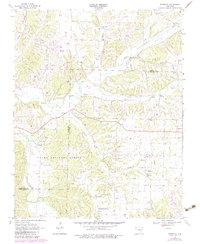
1970 Map of Robinson
USGS Topo · Published 1983About this map
Robinson and Tontitown anchor this rural landscape along the boundary between Benton and Washington Counties during the late twentieth century. The terrain is defined by the winding course of the Illinois River and its many tributaries, including Osage Creek, Wildcat Creek, and Brush Creek. This period of the 1970s and 1980s shows a transition toward more modern land use, including the presence of a large Pipeline and the University of Arkansas Agricultural Experiment Station in the southern portion of the quadrangle.
Find a feature on this map
24 named features on this map. Tap any name to fly to it.
Don’t see what you’re looking for? This feature index may not catch every label — zoom into the map to look around manually.
Map Details
Editions of this 1970 Robinson Map
3 editions found
Other maps of this area

1899 · Fayetteville
USGS Topo · 1:125,000

1901 · Fayetteville
USGS Topo · 1:125,000

1904 · Fayetteville
USGS Topo · 1:125,000

1954 · Tulsa
USGS Topo · 1:250,000

1958 · Fayetteville
USGS Topo · 1:24,000

1958 · Tulsa
USGS Topo · 1:250,000

1963 · Tulsa
USGS Topo · 1:250,000

1970 · Gallatin
USGS Topo · 1:24,000

1970 · Robinson
USGS Topo · 1:24,000
1970 · Bentonville South
USGS Topo · 1:24,000