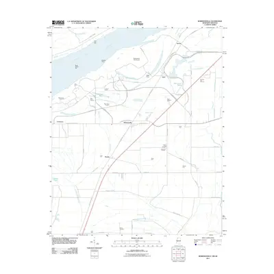
2011 Map of Robinsonville
USGS Topo · Published 2011About this map
Robinsonville and the surrounding Mississippi Delta floodplain are defined by the winding course of the Mississippi River and the legacy of its former channels. This 2011 survey illustrates the modern casino-driven landscape of the Casino Strip Resort Blvd and Casino Center Dr, contrasting sharply with the deep-rooted agricultural and spiritual history of the region. Numerous family-named operations like Bennet Farm, Erwin Company Farm, and Flynn Farm dot the landscape alongside vital local landmarks. For genealogists, the map is particularly valuable for its documentation of historical burial grounds, including Saint Peters Cemetery, Morning Star Cemetery, and Johnson Chapel Cemetery. The terrain is shaped by water features such as Old River Lake and Fish Lake Bayou, while engineering works like the Polk Landing Revetment and Porter Lake Dikes indicate the ongoing efforts to manage the river's influence on the Tunica County shoreline.
Find a feature on this map
62 named features on this map. Tap any name to fly to it.
Don’t see what you’re looking for? This feature index may not catch every label — zoom into the map to look around manually.
Map Details
Editions of this 2011 Robinsonville Map
This is the sole edition of this map. No revisions or reprints were ever made.
Other maps of this area

1908 · Hollywood
USGS Topo · 1:24,000

1908 · Lake Cormorant
USGS Topo · 1:24,000

1912 · Lake Cormorant
USGS Topo · 1:31,680

1913 · Hollywood
USGS Topo · 1:31,680

1931 · Horseshoe Lake
USGS Topo · 1:62,500

1932 · Horn Lake
USGS Topo · 1:48,000

1932 · Crenshaw
USGS Topo · 1:62,500

1935 · Crenshaw
USGS Topo · 1:62,500

1935 · Horn Lake
USGS Topo · 1:62,500

1939 · Clayton
USGS Topo · 1:62,500